Mountain Profile
Major jump-offs: Poblacion and Barangay Hapao, Hungduan
Alternative jump-off: Balentimol Falls, Hungduan
Elevation: 2,642 MASL
Difficulty: 7/9, Major Climb
Trail Class: 3
Days Required: 1-2 days
Hours to Summit: 9 hours
Source: Pinoy Mountaineer

A Bloody Trail (Balentimol Falls to Poblacion Traverse)
Nestled in the Cordilleran mountain range are some of the country’s most mystical and haunting mountains. One such mystical mountain is Ifugao’s Mt. Napulauan. Situated in the municipality of Hungduan, and towering at 2,642 MASL, Mt. Napulauan, or Napulawan as the locals spell it (either way is correct), is the country’s 16th highest mountain. In Ifugao, it is only overshadowed by Mt. Amuyao, the “unofficial” tenth highest mountain in the country.
For years, Mt. Napulauan remained largely obscured and unknown to most. Everything changed with the dawn of technology and social media. Exploratory climbs have since been made, helping establish a primary trail. When climbing became a popular hobby, organizers started organizing climb events to Mt. Napulauan. The mountain has also become a popular trail running destination.
Caveat, climbing the mountain is challenging. A major hike, it requires at least two days to climb the mountain. However, daredevils are known to complete the trek in a day. The original jump-off trail originates at either Poblacion or Barangay Hapao. These trails are often combined to complete a traverse loop. Lately, organizers have been utilizing the trail that passes by Balentimol Falls. Recently established, it is said that this trail is more treacherous and steeper compared to the other trails. What makes the Balentimol trail treacherous is its endless assaults, especially at the start. There are parts of the trail that gets really narrow.
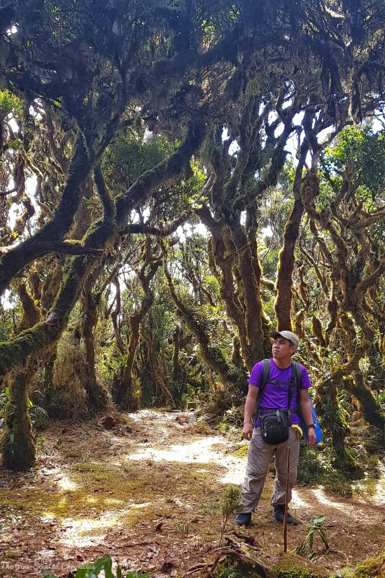
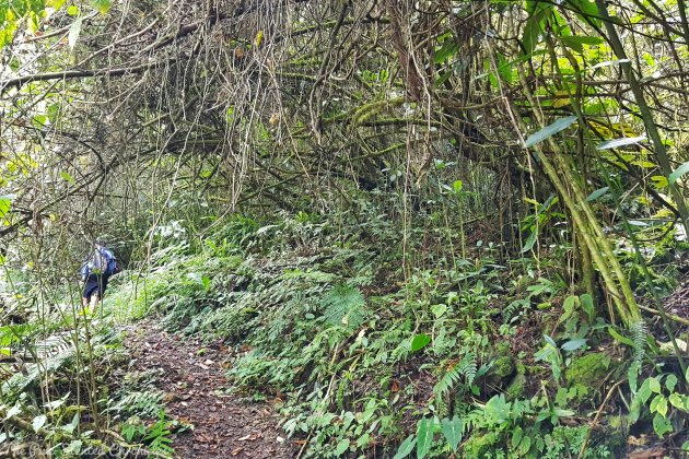
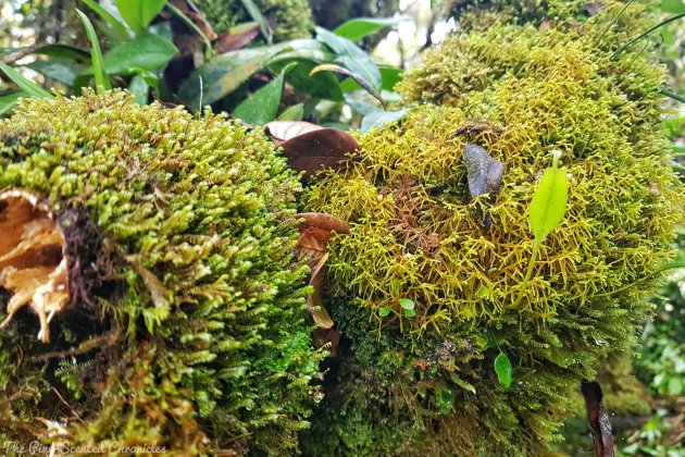
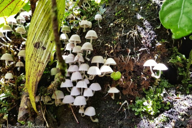
The trail opens up to a pine trail. As one climbs higher, the foliage starts to transform. The pine trees are slowly replaced by a beautiful disarray of different trees. You have now entered the mossy forest which is lush with its plethora of ferns, lichen-wrapped trees, and moss- carpeted trail. I find mossy forests eerie because of their ethereal qualities reminiscent of my imagination of the famed and fabled Black Forest. Nevertheless, I am astounded by the lush and rich life, both flora and fauna, teeming with its boundaries. The thick mossy forest is just one of the charms of Mt. Napulauan.
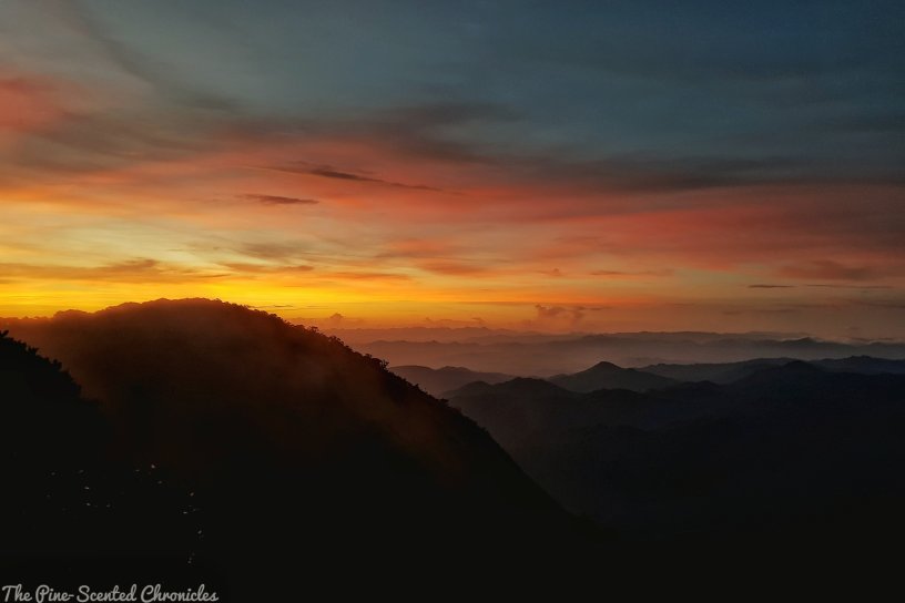
The tough climb is rewarded by a wonderful view at the summit which offers a 360-degree view featuring the thickly-forested mountains of the Cordilleras. From the summit, one can view other prominent Cordilleran mountains like the mighty Mt. Pulag, Mt. Amuyao, Mt. Tabayoc and Mt. Ugo. On a good day, especially during the summer season, one can be greeted in the morning by a prominent display of sea of clouds. The summit is a great vantage point to witness a dramatic sunrise.
The descent to Poblacion, as expected, is less taxing compared to the ascent. For about an hour or two, one will once again navigate the verdant mossy forests of Mt. Napulauan. As one climbs down, one can notice how the hierarchal transformation of the trail from the mossy forest to the pine forest, to eventually, the open grasslands. The descent culminates with an amazing view of the rice terraces of Poblacion. The descent can take an average of four to five hours to complete.
For historically inclined, Mt. Napulauan might appeal to you. It is often associated with the Tiger of Malaya, Japanese General Tomoyuki Yamashita. While fleeing, he retreated to the slopes of the mountain. Yamashita was later captured in the neighboring municipality of Kiangan.
Travelling to Hungduan
To get to Hungduan, you may refer to below link:
Practicalities
- A large portion of the climb is comprised of navigating a mossy forest. That is, in itself, a caveat. Lurking in mossy forests are tiny creatures that terrifies even the most seasoned of climbers – limatik, or blood leeches. These pesky creatures can be really bothersome, and at times, frustrating, during the climb, especially during the rainy season. As a precaution, fully cover one’s self or minimize exposed parts of the body.
- Bring alcohol or any mint-based products. They can’t repel the limatik but they can come handy when one is bitten by them. When bitten by the limatik, one must not forcefully pull them off because its teeth will get left behind. Instead, pour alcohol or, salt on the limatik so that they can detach themselves *voluntarily*. Alternatively, you can wait for the limatik to get full. What’s important is to let the limatik naturally detach and not force it.
- The mossy forest part of the trail is thickly covered. The trail is quite established but still, one can easily lose one’s way on this part. Although there were red ribbons tied on trees, they were placed far in between. It is important to wait for your guide.
- There are roped sections in the Balentimol trail. There are no river crossings although you will pass through two waterfalls.
- It can get really cold, especially from November to February. Always bring thick jackets or warmers.
- Leave No Trace. These are just three simple words that sum up the most important principle in mountain climbing, and even in traveling. Unfortunately, not everyone adheres to this very simple principle – what you bring up, you must bring down.
Guides and Expenses
- Tour guides are required. Inquire at the municipal tourism office for tour guides. If possible, make arrangement with the tour guides at least three days ahead of planned climb. For a group of three, we each spent PHP 1,000 for our guide. This covered our breakfast, utensils and burner. We only have to buy butane for the burner.
- A tourism registration fee of PHP 100.00 is required to be paid at the tourism information center located in Barangay Bokiawan.

Mountain Echoes
Mt. Napulauan was a challenging climb. Other than the fact that it is a major climb, a lot of the elements hampered our climb. We started the climb with a fair weather but found ourselves soaking at the summit as the monsoon rain started pouring midway through our climb. Moreover, the attack of the pesky limatik is real. Them falling down with the rain is very frustrating. At countless times, I was honestly about to crash and just give up. However, I am thankful that I kept trudging on as it reminded me that we cannot always expect everything to flow in our favor, the same with life. It is in these kinds of challenges that our true characters are tested. We can either choose to whine about it or just work hard and complete it.
Mt. Napulauan is a bad-ass! Till the next climb!
Mt. Napulauan Itinerary
Day 0
0930H Assembly – Ohayami Trans Terminal
1000H ETD Banaue, Ifugao
Day 1
0700H ETA Poblacion, Banaue, Ifugao. Breakfast
0800H ETD Hungduan
0900H Brgy. Bokiawan, pay registration fee at Hungduan Tourism Office
0930H ETA, Brgy. Hapao. Snap pictures of the rice terraces
1000H ETA Hungduan, pre-climb preparations
1100H Start trek
1115H Balentimol Falls, first water source
0145H Second water source. Late lunch
0230H Resume trek
0600H ETA Summit
0630H Pitch tent
0700H Dinner
0800H Lights out
Day 2
0500H Wake up call
0600H Take pictures of sunrise. Explore summit
0730H Prepare breakfast
0800H Breakfast
0830H Prepare for descent
0900H Start descent
1100H Wate rsource
1200H ETA jump-off point (Poblacion), washup
1600H ETD Banaue
1730H ETA Banaue
1900H ETD Manila
To read more about my Mt. Napulauan adventures, please click on the link below:
The Great Cordilleran Traverse: Mt. Napulauan, A Bloody Climb